3D Tours for Campuses and Public Spaces
Plan 3D tours for campuses and public spaces with landmarks, routes, access notes, zone labels, and browser sharing.

Plan 3D tours for campuses and public spaces with landmarks, routes, access notes, zone labels, and browser sharing.
Campuses and public spaces need route clarity, landmarks, access notes, and area-level context.
Short answer
Large spaces are easier to understand when a tour combines movement with named zones and maps.
Campuses and public spaces need route clarity, landmarks, access notes, and area-level context. A useful test is simple: can someone open the tour, understand the place, and know what to do next without a separate explanation?
Spatial Studio gives campus teams cloud generation from phone, 360, drone, photo, and mixed media; Mac local generation; Spatial Lens on iPhone Pro; and compatible PortalCam workflows. The result can become a browser tour with routes, accessibility context, embeds, and analytics.
How to judge the workflow
| Visitor | First need | Useful route |
|---|---|---|
| Prospective student | Scale and atmosphere | Entrance, academics, housing, student life |
| Event guest | One destination | Parking or transit, entrance, venue |
| New employee | Daily navigation | Arrival, reception, department, facilities |
| Public visitor | Access and rules | Welcome point, accessible route, key spaces |
Practical checklist
- Start with the main arrival point.
- Add stops for landmarks and decision points.
- Use hotspots for access, hours, and amenities.
- Embed the tour on visitor information pages.
- Track which areas receive the most attention.
Why Real Horizons is different
Real Horizons connects cloud splat generation with guided tour publishing. Spatial Studio supports captures from smartphones, 360 cameras, 360 drones, standard drones, DSLR/photo sets, and mixed media workflows. That matters when a campus or public-space team wants one path from route, landmark, exterior, or aerial capture to a usable public tour instead of stitching together separate tools for processing, viewer setup, publishing, and visitor handoff.
Common mistakes
- Building one giant route for every visitor.
- Showing restricted areas or sensitive access details.
- Treating stairs as the default route.
- Publishing seasonal information without an owner.
- Replacing an accessible text map with a visual tour.
Commercial packaging example
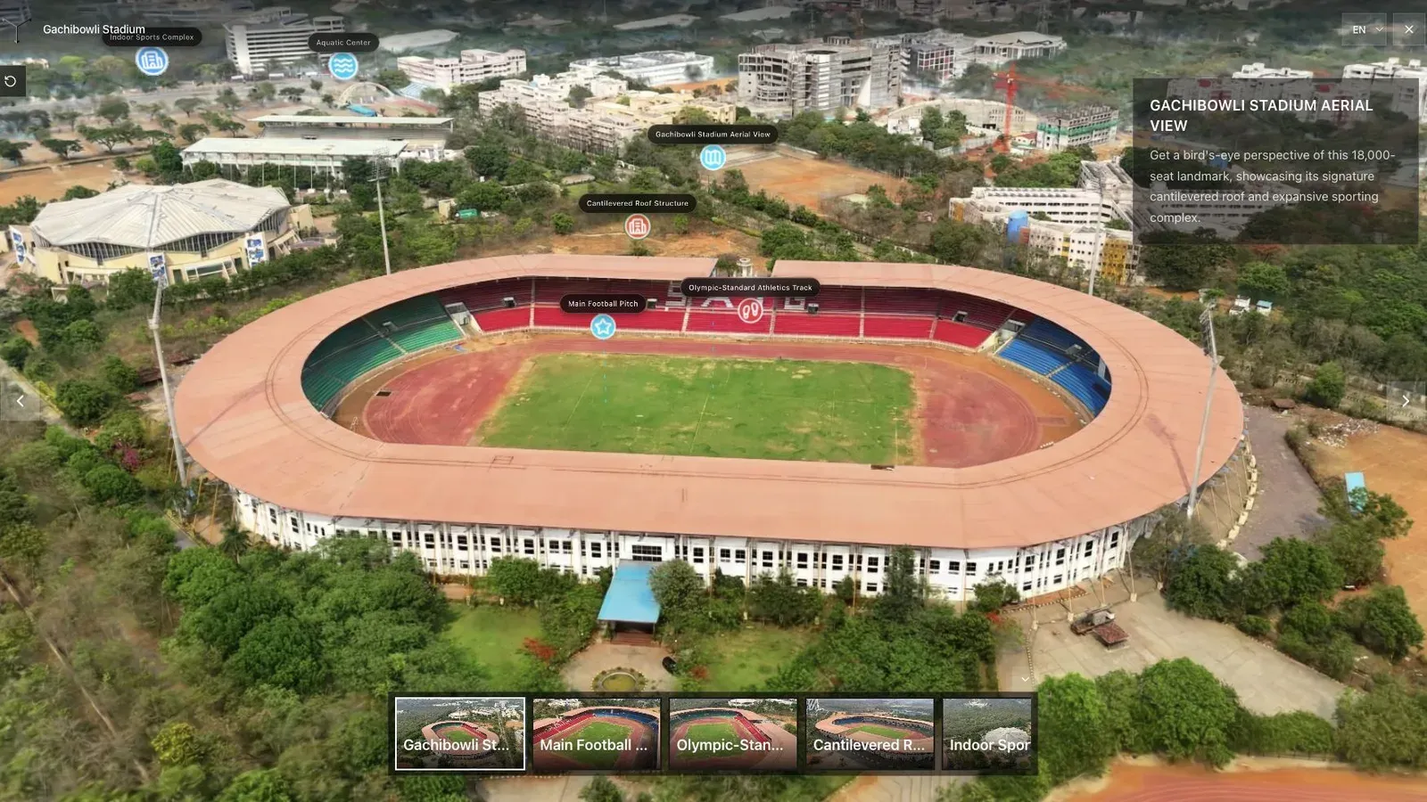
A venue tour should make scale, access, and the main viewing areas clear immediately.
For this use case, the important question is what the tour helps a visitor understand. A student, parent, resident, guest, or destination visitor may need arrival context, landmarks, accessible routes, building relationships, and links they can revisit later. For campus teams, public-space managers, and destination marketers, the tour should make orientation easier within the first few seconds.
Pair spatial views with practical information: hours, accessible entrances, elevator access, visitor check-in, transit, and contact details. Keep changing facts in maintainable fields rather than baking them into imagery.
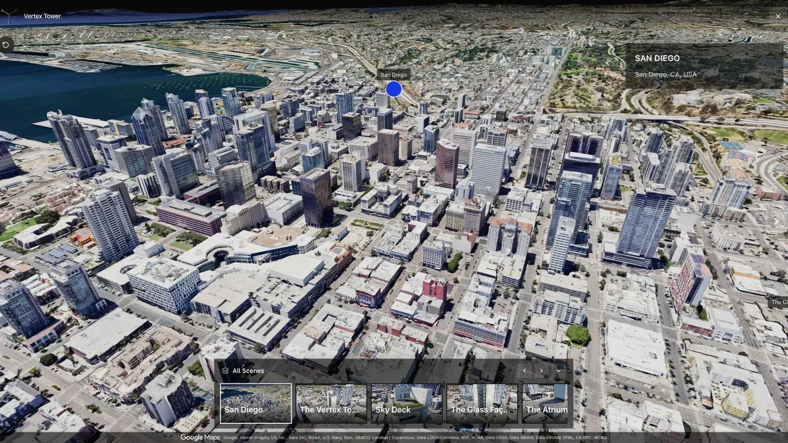
A city-scale map tour gives large sites the context that a room-by-room viewer cannot provide alone.
Use aerial capture to explain geography, ground-level splats for route recognition, and conventional maps for precise navigation. The tour complements official wayfinding and accessibility resources; it should not claim to replace them.
Have security, accessibility, facilities, and communications review the route. Set owners for closures and seasonal updates, and offer plain-text alternatives for essential directions. For authoring choices, see Splat Virtual Tour Software.
Questions campus teams ask
Should one tour cover the whole campus?
Use a broad orientation layer, then create shorter routes for admissions, events, public services, or facilities. A single linear route becomes difficult to maintain and asks every visitor to cross irrelevant areas.
Is a 3D tour an accessibility map?
No. It can add useful visual context, but official accessible-route information must come from verified campus resources and remain available in accessible text or map form.
Related reading
Next step
Open the related workflow.
Review live examples or move straight into the matching Spatial Studio flow.
Continue reading
Related articles
Commercial Use Cases
3D Map Tours for Land and Plot Sales
Use 3D map tours for land and plot sales to connect drone context, plot availability, access, landmarks, and buyer decisions.
Read articleCommercial Use Cases
3D Property Damage Documentation for Insurance and Restoration
Plan 3D property damage documentation for insurance and restoration using photos, 360 capture, Gaussian splats, guided review, and clear evidence boundaries.
Read article