3DGS Virtual Tour Guide
Build a 3DGS virtual tour with a clear first view, waypoints, labels, hotspots, CTA, embed, and analytics plan.

Build a 3DGS virtual tour with a clear first view, waypoints, labels, hotspots, CTA, embed, and analytics plan.
A 3DGS virtual tour needs structure: first view, stops, labels, hotspots, CTA, embed, and analytics.
Short answer
A raw scene asks visitors to explore. A tour gives them a path.
A 3DGS virtual tour needs structure: first view, stops, labels, hotspots, CTA, embed, and analytics. A useful test is simple: can someone open the tour, understand the place, and know what to do next without a separate explanation?
A 3DGS virtual tour uses a Gaussian-splat scene as its navigable visual layer, then adds a first view, guided stops, information, sharing, and a next action. The splat supplies appearance and spatial freedom; the tour design makes it understandable to someone who did not create it.
How to judge the workflow
| Layer | Decision |
|---|---|
| Capture | Phone, 360 camera, drone, photos, or a planned mix |
| Reconstruction | Quality, processing location, time, and cost |
| Scene preparation | Cleanup, orientation, and delivery weight |
| Tour authoring | Opening view, route, hotspots, and story |
| Distribution | Link, embed, access, branding, and analytics |
Practical checklist
- Set a first view that explains the space.
- Add waypoints for key rooms or zones.
- Use hotspots only where context changes a decision.
- Add a clear next action.
- Track which stops get used.
Why Real Horizons is different
Spatial Studio spans those layers with cloud generation from phone, 360, drone, photos, and mixed media; local generation on Mac; Spatial Lens capture on iPhone Pro; compatible PortalCam workflows; browser review; tour authoring; embeds; CTAs; and analytics. Existing splats can also enter the publishing workflow.
Common mistakes
- Comparing a free viewer with an end-to-end production service as if they do the same job.
- Calling an orbitable file a finished tour.
- Choosing the capture method after arriving on site.
- Optimizing only for desktop quality.
- Publishing without an owner for access and updates.
Published-tour checks that matter
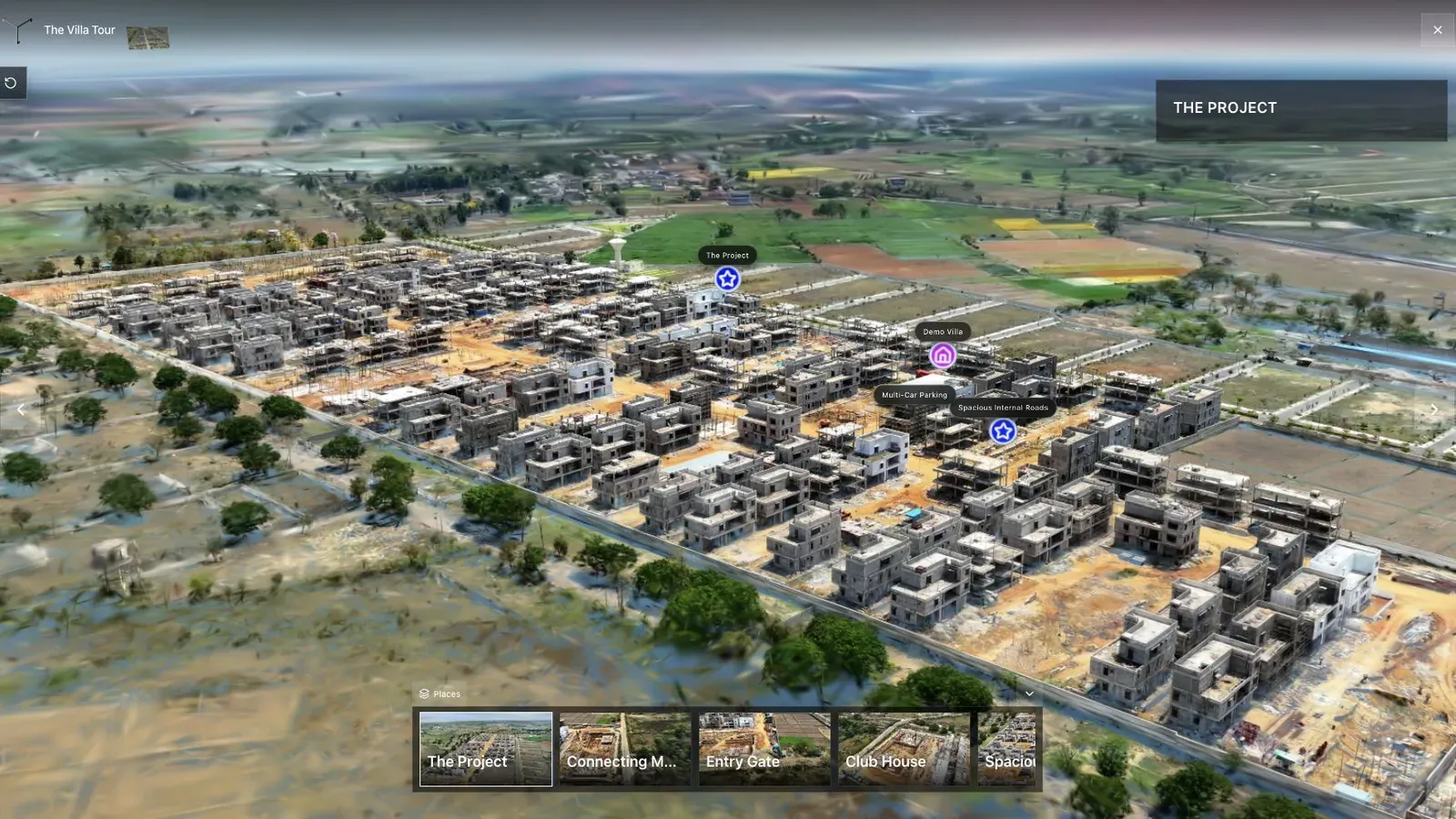
A land-development tour combines aerial context, waypoints, and site detail in one published view.
The land-development scene shows the difference between asset and experience. A usable first view establishes the site; named stops then connect scale, access, plots, and nearby context.
Approve the splat before authoring. Then choose an opening camera, add a short route around audience questions, use hotspots only for missing context, and finish with one relevant action.
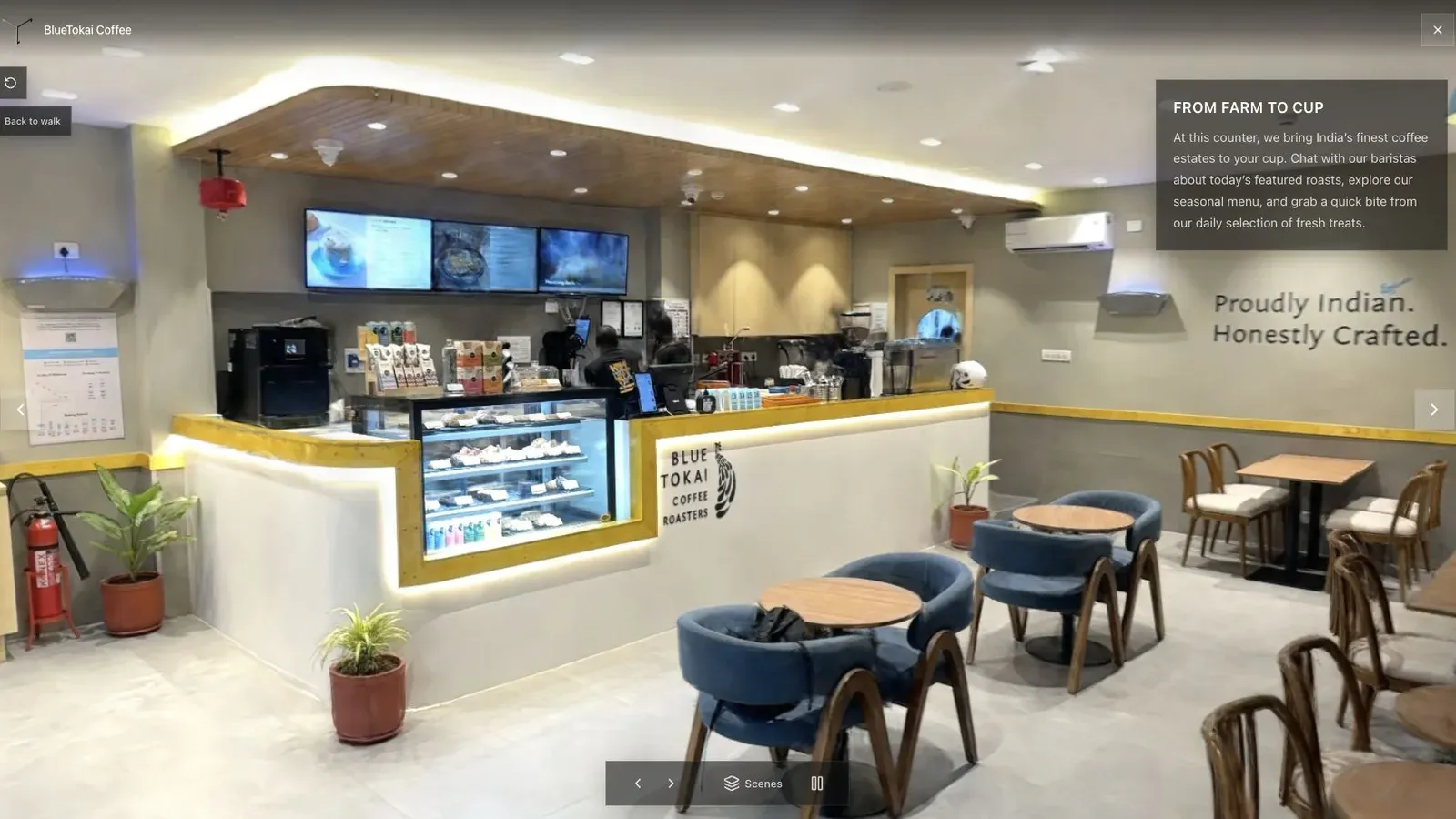
A published cafe tour gives visitors a clear first view before they move through the space.
The cafe scene should tell a new visitor what kind of place this is before they touch the controls. Movement should reveal spatial relationships without exposing capture fringe or making the subject dissolve.
A specialist editor can still offer deeper cleanup, and a custom PlayCanvas build can offer more code-level control. Spatial Studio is compelling when quality, input flexibility, and a short path from capture to client-ready publishing matter together.
Open the tour cold on a phone and use only its named route. If a client needs a live explanation to understand the scene, the authoring is not finished. For more, see Splat Virtual Tour Software.
Check the first stop with someone who has not seen the capture before; if they understand the space quickly, the tour is doing its job.
Questions people ask
Is a 3DGS tour the same as a 360 tour?
No. A 360 tour connects fixed panoramic viewpoints. A Gaussian-splat tour renders a reconstructed scene and can allow freer spatial movement. Each has different capture, performance, and presentation trade-offs.
Can an existing splat become a tour?
Yes, if the file and scene are compatible with the publishing tool. Check orientation, scale, visual cleanup, and web weight before building the route around it.
Related reading
Next step
Open the related workflow.
Review live examples or move straight into the matching Spatial Studio flow.
Continue reading
Related articles
Tour Publishing
360 Tour vs Gaussian Splat Tour
Compare 360 tours and Gaussian splat tours by capture speed, viewer experience, mobile performance, embeds, and sales use.
Read articleTour Publishing
How to Embed a Gaussian Splat Viewer on Your Website
Embed a Gaussian splat viewer or 3D tour with responsive iframe code, mobile checks, CMS notes, performance guidance, and publishing tips.
Read article