Virtual Tours for Developer Sales Centers
Create virtual tours for developer sales centers that connect model units, amenities, site context, floor plans, and inquiry paths.

Create virtual tours for developer sales centers that connect model units, amenities, site context, floor plans, and inquiry paths.
Developer tours should connect model units, amenities, site context, floor plans, and inquiry actions.
Short answer
A sales-center tour works when it helps buyers remember the project and continue the conversation.
Developer tours should connect model units, amenities, site context, floor plans, and inquiry actions. A useful test is simple: can someone open the tour, understand the place, and know what to do next without a separate explanation?
Spatial Studio supports cloud generation from model units, sales centers, drone context, photos, 360, and mixed captures, plus Mac local generation and Spatial Lens on iPhone Pro. Teams can publish unit- and amenity-specific routes, embeds, inquiry CTAs, and analytics while the project evolves.
How to judge the workflow
| Buyer task | Tour support |
|---|---|
| Recall the visit | Named model-unit and finish waypoints |
| Compare options | Unit-specific links and clearly labeled differences |
| Understand the site | Aerial context, amenities, access, and phase relationships |
| Continue the conversation | Preserved unit interest in the sales inquiry |
Practical checklist
- Start with project context before room detail.
- Add stops for model units and amenities.
- Use hotspots for finishes, views, and inventory notes.
- Link to inquiry or booking actions.
- Measure tour use by campaign or agent.
Why Real Horizons is different
Real Horizons connects cloud splat generation with guided tour publishing. Spatial Studio supports captures from smartphones, 360 cameras, 360 drones, standard drones, DSLR/photo sets, and mixed media workflows. That matters when a developer team wants one path from model-unit, amenity, site, or aerial capture to a sales-center tour instead of stitching together separate tools for processing, viewer setup, publishing, and buyer follow-up.
Common mistakes
- Blending model-unit finishes with standard specifications.
- Showing future amenities as if they already exist.
- Publishing stale availability or phase information.
- Building one route that mixes incompatible unit types.
- Dropping buyer and unit context at the inquiry form.
Commercial packaging example
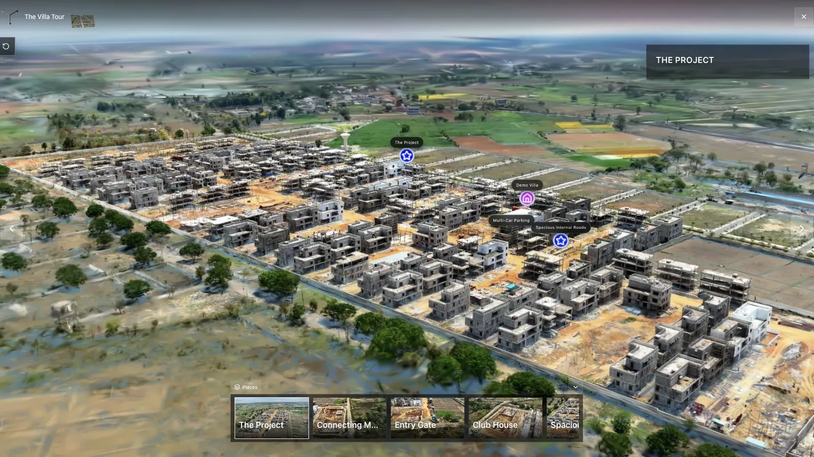
A land-development tour combines aerial context, waypoints, and site detail in one published view.
For this use case, the important question is what the tour helps a buyer remember and compare. A developer buyer may need model-unit context, amenity relationships, finish notes, site context, floor-plan links, and a direct path back to the sales team. For property developers, sales-center teams, and project marketers, the tour should keep that conversation clear after the visit.
Separate captured reality, show-unit upgrades, and proposed content. Use explicit labels and linked approved documents so a buyer can tell what is included, optional, representative, or still planned.
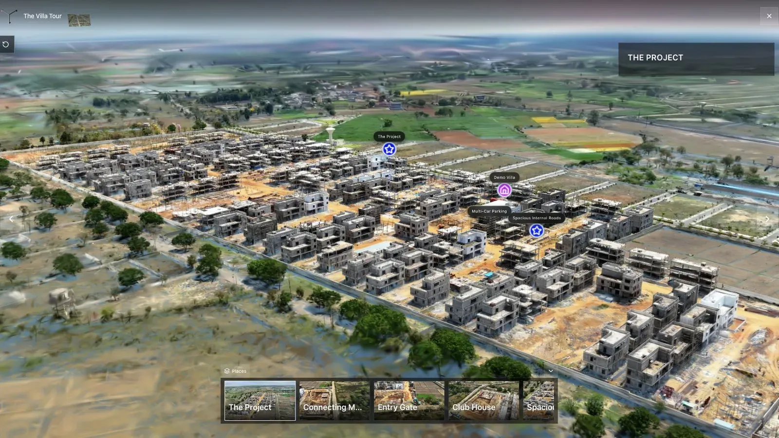
Waypoints turn a large scene into a guided path instead of leaving visitors to guess where to go next.
Combine a site overview with concise routes for each model and shared amenity. Preserve stable tour links where possible, but display capture and update dates so an old sales message never masquerades as current inventory.
Have sales, legal, design, and construction review every representation. Connect unit IDs and campaign source to the CRM, assign an availability owner, and archive replaced versions. For land and plot context, see 3D Map Tours for Land Sales.
Questions developer teams ask
Can proposed spaces appear beside captured reality?
Yes, but label them unambiguously and keep approvals consistent with other sales material. A buyer should be able to tell what is captured, representative, optional, or planned.
How should availability updates work?
Use the sales system as the authority, preserve unit IDs through inquiry, and assign an owner for public labels. Show a review date when the tour cannot read live inventory.
Related reading
Next step
Open the related workflow.
Review live examples or move straight into the matching Spatial Studio flow.
Continue reading
Related articles
Commercial Use Cases
3D Map Tours for Land and Plot Sales
Use 3D map tours for land and plot sales to connect drone context, plot availability, access, landmarks, and buyer decisions.
Read articleCommercial Use Cases
3D Property Damage Documentation for Insurance and Restoration
Plan 3D property damage documentation for insurance and restoration using photos, 360 capture, Gaussian splats, guided review, and clear evidence boundaries.
Read article