Gaussian Splatting for Venues and Event Spaces
Use Gaussian splatting for venues and event spaces to show capacity, flow, setup zones, access, and booking context.

Use Gaussian splatting for venues and event spaces to show capacity, flow, setup zones, access, and booking context.
Venue tours should answer capacity, flow, access, setup zones, and booking questions.
Short answer
Event buyers need to imagine a specific use of the room instead of only looking at an empty hall.
Venue tours should answer capacity, flow, access, setup zones, and booking questions. A useful test is simple: can someone open the tour, understand the place, and know what to do next without a separate explanation?
Spatial Studio lets venue teams generate from phone, 360, drone, photo, or mixed capture in the cloud, work locally on Mac, or capture with Spatial Lens on iPhone Pro. Tours can then carry room routes, capacity documents, hotspots, embeds, availability CTAs, and analytics.
How to judge the workflow
| Planner question | Tour evidence |
|---|---|
| Will guests fit? | Representative layouts plus linked approved capacity sheets |
| How will they move? | Arrival, registration, room flow, exits, and accessible routes |
| Can production work? | Stage, sightlines, loading, power, and service access context |
| Is the date open? | Event-specific availability or proposal request |
Practical checklist
- Add stops for entrance, main room, stage, outdoor areas, and back-of-house paths.
- Use hotspots for capacity and setup notes.
- Show multiple layout options when possible.
- Place inquiry CTAs near decision points.
- Track which spaces attract the most clicks.
Why Real Horizons is different
Real Horizons connects cloud splat generation with guided tour publishing. Spatial Studio supports captures from smartphones, 360 cameras, 360 drones, standard drones, DSLR/photo sets, and mixed media workflows. That matters when a venue team wants one path from room, stage, outdoor, or aerial capture to a usable booking tour instead of stitching together separate tools for processing, viewer setup, publishing, and client delivery.
Common mistakes
- Showing one aspirational layout as the only possible setup.
- Inferring legal capacity from visual appearance.
- Hiding loading, service, accessibility, or weather constraints.
- Sending every planner through unrelated rooms.
- Using an inquiry that drops the room and event context.
Commercial packaging example
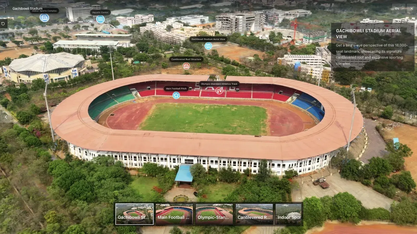
A venue tour should make scale, access, and the main viewing areas clear immediately.
For this use case, the important question is what the tour helps a planner decide. A venue buyer may check guest flow, stage visibility, catering access, outdoor options, and how a room could be set up for a specific event. For venue owners, event sales teams, and hospitality marketers, the tour should make those decisions easier within the first few seconds.
Offer short room-specific routes and a separate arrival overview. Link approved capacity, dimensions, floor plans, catering, and production documents instead of crowding those details into the spatial view.
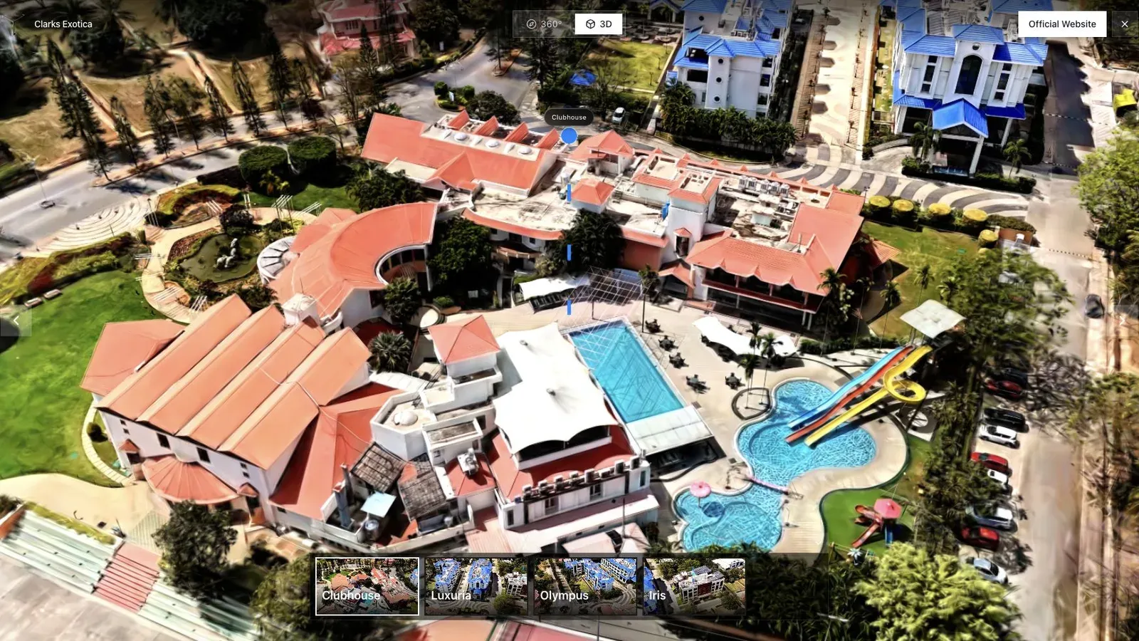
A resort or hospitality tour benefits from an opening view that shows amenities and surrounding context.
Show representative setups, but label furniture and production elements that are optional. For outdoor venues, make season, weather contingency, noise, access, and daylight conditions explicit.
Have sales and operations verify room names, documents, current condition, and routing. Preserve the selected room, event type, guest count, and source when a planner requests availability. See CTAs Inside 3D Tours for conversion design.
Questions venue teams ask
Can a tour prove room capacity?
No. It can help a planner understand scale and layout, but legal or approved capacity must come from current venue documentation. Link that document beside representative layouts.
Should each room have its own tour?
For a multi-room venue, short room-specific routes usually qualify leads faster. Keep a separate overview for arrival, circulation, shared areas, and outdoor context.
Related reading
Next step
Open the related workflow.
Review live examples or move straight into the matching Spatial Studio flow.
Continue reading
Related articles
Commercial Use Cases
3D Map Tours for Land and Plot Sales
Use 3D map tours for land and plot sales to connect drone context, plot availability, access, landmarks, and buyer decisions.
Read articleCommercial Use Cases
3D Property Damage Documentation for Insurance and Restoration
Plan 3D property damage documentation for insurance and restoration using photos, 360 capture, Gaussian splats, guided review, and clear evidence boundaries.
Read article