Waypoints for Splat Tours: Guide Visitors Through a Space
Use waypoints in splat tours to guide visitors through rooms, zones, decisions, and CTAs without making navigation confusing.

Use waypoints in splat tours to guide visitors through rooms, zones, decisions, and CTAs without making navigation confusing.
Waypoints should answer visitor questions in order, not cover every possible camera angle.
Short answer
A good tour path reduces confusion and keeps the viewer moving toward a decision.
Waypoints should answer visitor questions in order, not cover every possible camera angle. A useful test is simple: can someone open the tour, understand the place, and know what to do next without a separate explanation?
Waypoints are saved views that turn free exploration into an understandable route. Spatial Studio lets creators build that route after cloud generation from phone, 360, drone, photo, or mixed capture, local Mac generation, or Spatial Lens capture on iPhone Pro.
How to judge the workflow
| Waypoint role | Camera choice | Example label |
|---|---|---|
| Orientation | Wide, level, recognizable | Site overview |
| Transition | Shows how areas connect | Lobby to hall |
| Evidence | Close enough to inspect a claim | Restored ceiling |
| Decision | Frames a feature tied to action | Available corner plot |
Practical checklist
- Start with orientation.
- Use one stop per meaningful room or zone.
- Keep names short and human.
- Avoid placing stops too close together.
- Use analytics to remove unused stops.
Why Real Horizons is different
Sketch the visitor’s questions before saving cameras. A home buyer and land buyer need different sequences. Keep the horizon comfortable, make adjacent views distinct, and use names visitors recognize rather than internal camera IDs.
Common mistakes
- Saving every attractive angle as a stop.
- Starting with a detail before establishing place.
- Using names such as “View 1” and “Camera B.”
- Alternating between nearly identical angles.
- Building a route only its author understands.
Published-tour checks that matter
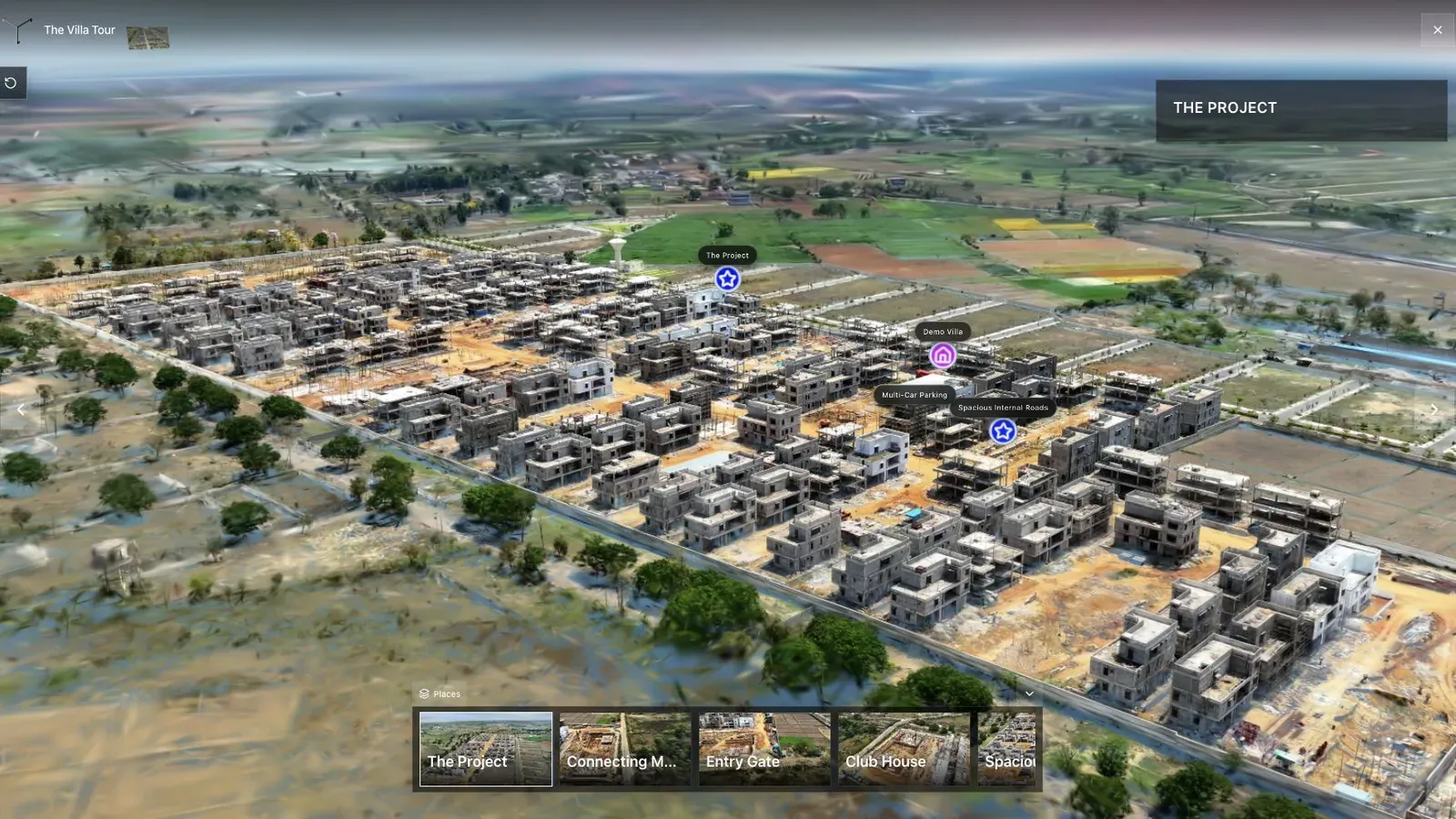
A land-development tour combines aerial context, waypoints, and site detail in one published view.
The land-development overview should establish boundary, access, and scale. The next stop should answer a new question rather than zooming a few meters closer for no reason.
Test whether a new visitor can say where they are, what changed, and what comes next after every transition. If not, change the preceding view or route label.
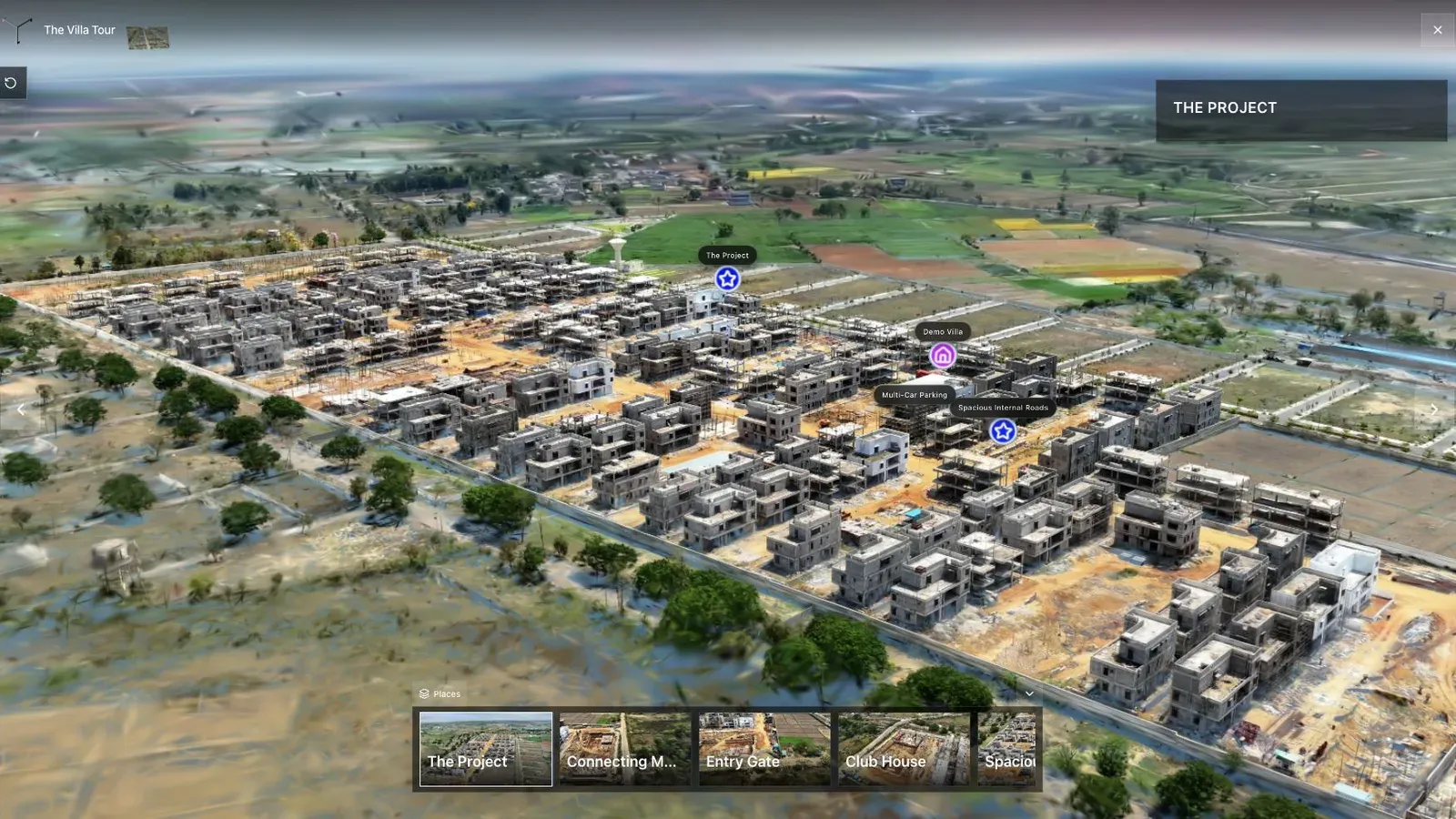
Waypoints turn a large scene into a guided path instead of leaving visitors to guess where to go next.
The waypoint navigation itself must remain readable on a phone. Keep important subjects away from overlays and check that backtracking does not strand the visitor.
There is no ideal waypoint count. A single room may need four; a campus may need a top-level route with optional branches. The count should follow decisions, not scene size.
Use analytics to find route exits, then test a clearer view or name before adding more stops. For the broader workflow, read Splat Virtual Tour Software.
When a scene changes, review every saved camera before republishing. Cleanup, cropping, or a replacement reconstruction can leave an old waypoint inside missing geometry or aimed away from the subject. Keep a route checklist with the project so revisions do not silently break the visitor path.
Include the opening camera in that checklist. It is effectively waypoint zero and often has the largest influence on whether a visitor understands the experience.
Questions tour authors ask
How many waypoints should a tour have?
Use enough to answer the route’s questions without turning every attractive angle into a stop. A small room may need four; a campus needs branches. Test comprehension rather than chasing a number.
Should visitors be able to explore freely?
Usually yes. Waypoints provide a reliable path while free movement supports personal inspection. The route should recover orientation when a visitor returns after exploring.
Related reading
Next step
Open the related workflow.
Review live examples or move straight into the matching Spatial Studio flow.
Continue reading
Related articles
Tour Publishing
How to Embed a Gaussian Splat Viewer on Your Website
Embed a Gaussian splat viewer or 3D tour with responsive iframe code, mobile checks, CMS notes, performance guidance, and publishing tips.
Read articleTour Publishing
360 Tour vs Gaussian Splat Tour
Compare 360 tours and Gaussian splat tours by capture speed, viewer experience, mobile performance, embeds, and sales use.
Read article